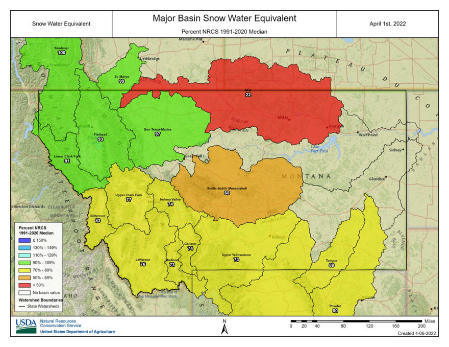
For the third consecutive month, precipitation was well below normal across most of Montana. Mountain snowpack is subpar across most of the state and time is running out to make up the difference.
March failed to deliver on widespread hopes for snowfall that would benefit Montana’s mountain snowpack. According to the USDA’s Natural Resources Conservation Service in Bozeman, snowpack is below normal across the state, except for northwest Montana and the northern Rocky Mountain Front. While those areas received near to above-normal precipitation, it mostly fell as rain due to unseasonably warm temperatures.
Current streamflow forecasts for southwest Montana and the main stem of the Missouri are all well below normal. The Rocky Mountain Front and river basins west of the Continental Divide are forecast to have near to above-normal flows, except for the Upper Clark Fork region which is forecast to be below normal.
According to NRCS, the best scenario for improved streamflows will be sustained cool weather and well above-normal spring precipitation. The National Climate Prediction Center however is not anticipating a strong chance for either.


