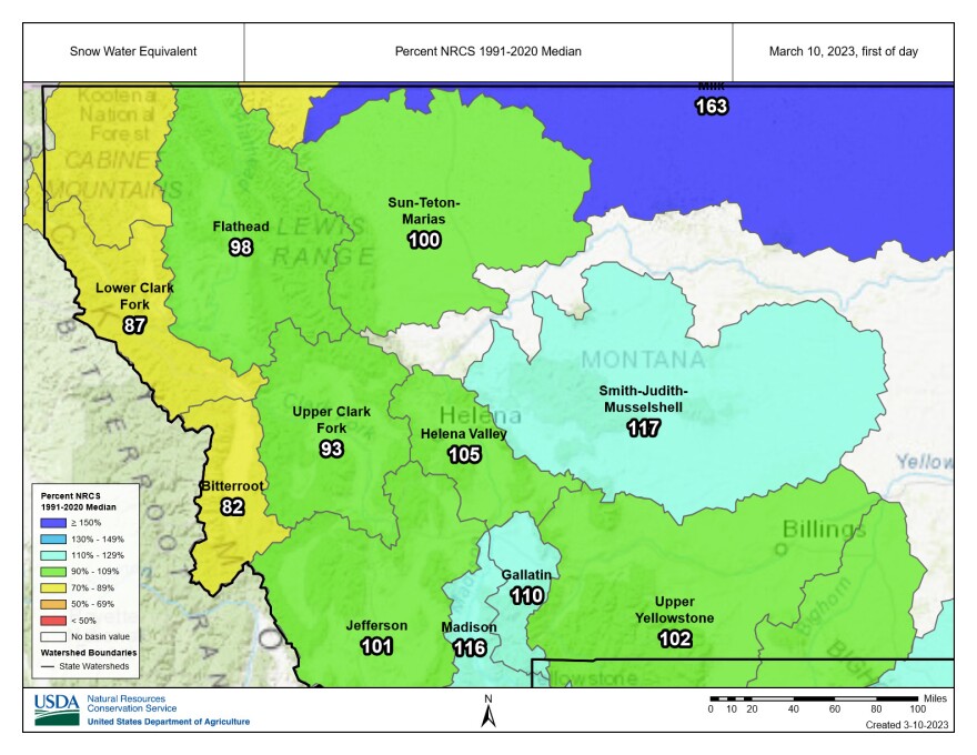
Above-normal precipitation last month boosted snowpack levels across most of the state.
The current snowpack gives experts some early insight into what the spring snow melt might look like.
According to the U.S. Agriculture Department’s Natural Resources Conservation Service in Bozeman, February’s precipitation was near-to-well-above normal across most of Montana.
The Smith-Judith-Musselshell region received well above normal amounts, with the Bitterroot lagging behind the rest of the state at about 80% of February’s normal amounts.
Most of the state’s current water supply forecasts are within 10% of normal. Exceptions include parts of central and southwest Montana which are currently forecasted to have above-normal streamflows this spring. Western Montana along the Idaho border is expected to have below normal streamflows.
Some regions, including the Madison, Gallatin, Little Belts, Big Belts, and Bighorn mountains, have accumulated a two-to-three-inch surplus of snow water equivalent. However, those regions are still three to six inches below their normal April peak snowpack levels.
NRCS says a lack of snowfall during the next couple months could result in a below normal snowpack in the spring, when it matters most. However, snowpack conditions could change over the next couple of months.


