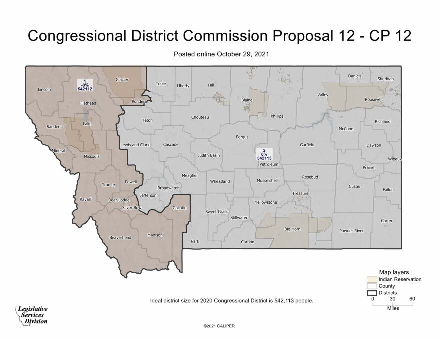
The commission drawing Montana’s new political boundaries has selected a single proposal dividing the state into two congressional districts.
The nonpartisan chairperson Maylinn Smith sided with the commission’s two Republican members to advance an east-west map that puts Lewis and Clark County in the east.
The two Democrats voted against the proposal. They advocated for a more competitive district, and an eastern district that included Kalispell.
Smith had pushed the commissioners to find consensus, but they failed to do so.
“It is the district that I find is the fairest for Montana based on the volumes of comments we’ve gotten, and I appreciate that a lot of people are not going to be happy with me, but that’s what I’m going to go forward with.”
The commission will take public comment on the map, known as CP-12, ahead of its next meeting in less than a week. The map could be tweaked, but must be finalized and submitted by Nov. 14.
Former Republican Gov. Marc Racicot and former Democratic Sen. Max Baucus submitted a letter together urging the commission to avoid splitting any counties and to keep at least two Indian reservations in each district.
Racicot spoke at the meeting, saying only the Republicans’ map fit that criteria.
“I and Max Baucus thought this was the most elegant out of all of the proposals and by elegant I mean, it met all — as many of the possible imperatives as possible as perfectly as possible.”
Organizations that advocate for Native American empowerment originally asked commissioners to keep at least two reservations in one competitive district.
However, they backed the Democrats’ map on Thursday even though it only had one tribe in one district.
Jacqueline DeLeon of the Native American Rights Fund said, “Our expert found that map 12 was not competitive except in exceptional instances.”
Montana gained back its second U.S. House seat as a result of population gain recorded by the 2020 census. The state’s sole House seat has been held by Republicans for the past two decades.


