Update: 6:30 p.m. 07/10/17
Tribal officials have increased the fire danger to “Extreme” on the west side of the Flathead Indian Reservation and “Very High” on the east side.
Fire managers for the Confederated Salish and Kootenai Tribes write in a press release that fine, dead fuels are drying out across the reservation. They add human behavior, such as tossing cigarette butts onto dry grass, leaving campfires unattended, lighting fireworks, burning debris and driving through dry grasses, has caused multiple grass fires across the Northern Rockies over the past week.
Elsewhere in the state, Type 2 Management Teams are being briefed on the Tongue River Complex Fires in Rosebud County and a smattering of fires burning in northwest Montana that are currently managed by the state Department of Natural Resources and Conservation.
3:00 p.m. 07/10/17
Fire danger is pegged at “Very High” in Missoula County and the Bitterroot National Forest following record-setting high temperatures in the past few weeks. On the west side of the Flathead Indian Reservation, fired danger is rated as “extreme." Fire restrictions are in place across most of central and eastern Montana.
Firefighters in the Bitterroot National Forest confirmed more than 500 lightning strikes on the forest in the past 24 hours. Crews responded to four fires ignited by lightning storms Sunday night and Monday morning, all less than an acre in size.
The fires are located on the West Fork, Darby/Sula and Stevensville Ranger Districts. Crews have contained or extinguished two and expect to contain the others later today or Tuesday, according to a press release from the BNF. Firefighters have responded to 8 human caused fires and 6 lightning wildfires this summer on the Bitterroot National Forest.
Outdoor debris burning by permit has been closed in Missoula County since July 4, and outdoor burning in Ravalli County will close at 12:01 am on July 13. Campfires must be contained to permanent rock rings or grates on county and National Forest lands.
A Stage 1 fire restriction is in place on private and public lands in several counties in eastern Montana. Building, maintaining, attending, or using a campfire is prohibited except within a developed recreation site or improved site.
See a full list of current fire restrictions.
2:00 p.m. 07/10/17
Several fires continue to burn in northwest and northcentral Montana today as hot and dry conditions persist.
The National Weather Service has issued a Red Flag Warning for central Montana through 11 p.m. due to hot and dry conditions, erratic winds and possible thunderstorms this afternoon. The warning includes the area of the July Fire burning southeast of Havre.
The communities of Hays, Landusky, Zortman and Lodgepole are being monitored for increased fire activity because of the potentially unstable weather. Crews are working today to contain the northwest flank of the fire to prevent its spread onto the Fort Belknap Indian Reservation and Blaine County a half mile away. Winds are currently blowing from the west. An estimated 50 percent of the 10,600-acre blaze is contained.
Several fires continue to burn in northwest Montana in the Pleasant Valley/Happy’s Inn/ACM/Fisher River area after a lightning storm moved through the area Friday afternoon. A Type 2 Team has arrived to manage the fires and will come online later this afternoon per the Montana Department of Natural Resources and Conservation’s request.
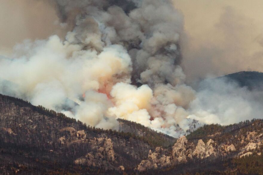
The DNRC says that evacuation notices have been initiated for the area of the Bend Ranger Station between Plains and Highway 2. That's due to the Lazier Creek 3 fire, which grew from 400 acres Sunday afternoon to 1,000 acres Monday morning. The smoke column for this fire is at times visible from Kalispell.
Pre-evacuation notices have been recommended for communities north of Highway 2 and northwest of Happy's Inn due to the Rogers Mountain Fire, which is estimated at 50 acres. The Lincoln County Sheriff's Office says they have notified residents, and that the fire is currently far enough from homes that no evacuation notices have been issued.
The DNRC is also managing a smattering of small fires in its Kalispell, Libby and Plains units, several of which were human-caused. Managers urge residents and recreationists in the area to be aware of high fire danger in the area. This means keeping campfires contained to rock rings and make sure they’re dead out, clearing dry brush away from structures and not flying drones or unmanned aircraft in areas where crews are actively managing fires.


